Left Natural Bridges National Monument, I took to the road again. Today's main attraction was still to come. It would be Monument Valley (at sunset), and that was about 70 miles away. Besides, I planed to visit Goosenecks State Park and Mexican Hat on the way, so I gotta hurry.
Soon I was on Route 261. There was a warning sign at the beginning of it, "no trucks". I wondered why, because the road condition was quite good: it just meandered over the gently rolling terrain southward, in a lush forest of dwarf pinyon pines. The weather was good, sunny and breezy. At an altitude of 6500 ft, it was actually quite comfortable. There was very little traffic. I felt good driving on the lonely road.
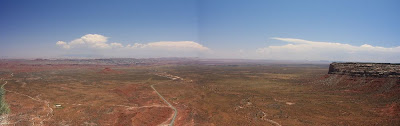
Then about 20 miles out, I suddenly learned why: there was a huge drop in the road and it was unpaved. Coming to the edge of Cedar Mesa, Mokee (Moki) Dugway took over. In the next 3 miles, it made several switchbacks on the side of the cliff, dropping 1100 ft in its course. Down there in the Valley of the Gods, was a desert decorated with buttes and painted hills. A vista so open and broad, everyone had to stop and enjoy.
Bell Butte in the foreground to the left, with Sugarloaf in the back.

I saw this board on the side of the road with lots of colorful stickers. Quite interesting. I wondered why this board was there to begin with. Not for those stickers, I guess?

I only learned the answer today!
Makeover of a road sign:
Here is a picture of this board copied from http://www.midwestroads.com/otherstates/mokidugway/
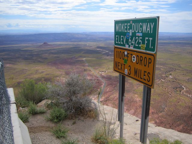
And another one on Flickr uploaded on Nov. 16, 2007 by Caddymob. Today was July 4, 2008. Go figure how fast it got covered up. I wonder how many people travel with stickers!
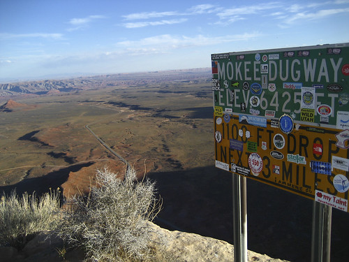
Last, this one (copied from http://www.imagesoftheworld.org/GrandCircle/mokidugway.html) seems to be the first photo of the road sign that I can find:

Looking to the south through mid-day haze, you can see Goosenecks in the foreground, and maybe Monument Valley in the background.

Looking southeast. Part of the switchback can be seen.

Looking east to northeast, Valley of Gods.

Route 316 off 261 brought us to Goosenecks State Park. Here San Juan River makes three 180-degree turns. The vista is so wide, I had to cover it with three shots with the widest angle. The following three shots were from left to right at Goosenecks. To see a good panoramic photo,
click here.


At the right side of the second Gooseneck, looking southwest, on the far horizon was Monument Valley.

Looking back northwest towards Cedar Mesa:

Looking northeast towards Sugarloaf:

Last stop: Mexican Hat:


 Unfortunately when I arrived, it was mostly cloudy.
 The signature view with two mittens, all in shadow.
 Three Sisters

 The sun cast rays on red rocks.


 A waxing moon appears next to I.M. Pei's John Hancock Tower.
 A Boston landmark, the Citgo sign, and the Harvard bridge are in the background of the firework barge on the Charles.
 The Prudential Tower basking in the setting sun. Behind it to the left is 111 Huntington Avenue, nicknamed the "R2-D2" Building.
 The John Hancock Tower and the Esplanade from the Longfellow Bridge. Notice the crowds.
 Memorial Drive from the Longfellow Bridge.
 At the Esplanade, waiting for the concert and fireworks.
 People rise when the Boston Pops plays the Star-Spangled Banner. See some people put their hands on their hearts.
 Then everyone looks east. Like bolts with roaring thunder coming from over the sea are the four fighter jets (red and green dots in the sky. Where am I focusing on?!显然是美女的头发).
 Passing overhead.
 It's getting dark.
 I don't have a good spot for the fireworks.
 There are many people in front of me. The die-hard photographers come several (>6) hours before the show to take the prime spots, near the water. I am definitely not die-hard, because I only realize after that my tripod head along with my camera vibrated during these long exposures. Sigh. Maybe I should invest in a remote release control and a better tripod. Nonetheless, the 20-min firework show looks fabulous. I'm so proud of my homeland for making this show possible.


 I saw this board on the side of the road with lots of colorful stickers. Quite interesting. I wondered why this board was there to begin with. Not for those stickers, I guess?
 Looking southeast. Part of the switchback can be seen.
 Looking east to northeast, Valley of Gods.


 At the right side of the second Gooseneck, looking southwest, on the far horizon was Monument Valley.
 Looking back northwest towards Cedar Mesa:
 Looking northeast towards Sugarloaf:


